
Editors Note: You can find Morgan online on Instagram and follow more of her adventures there!
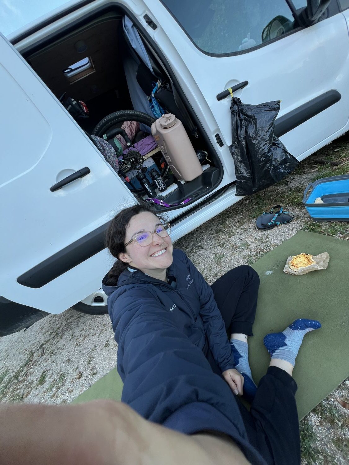
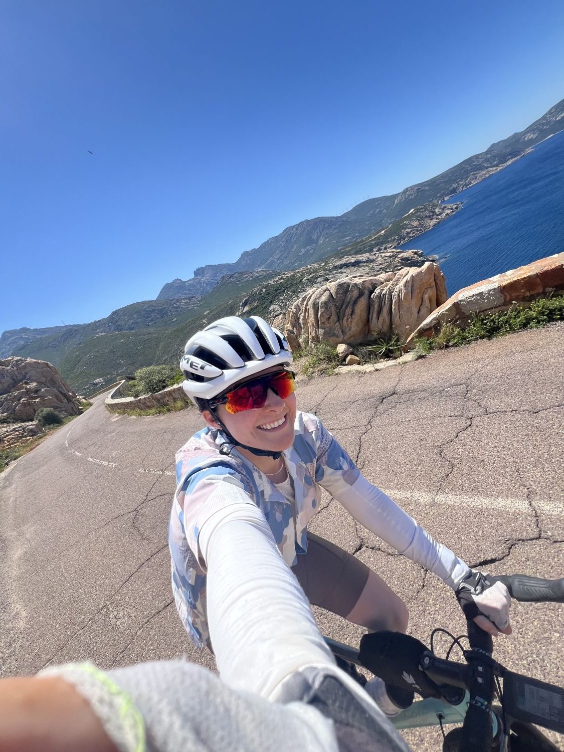
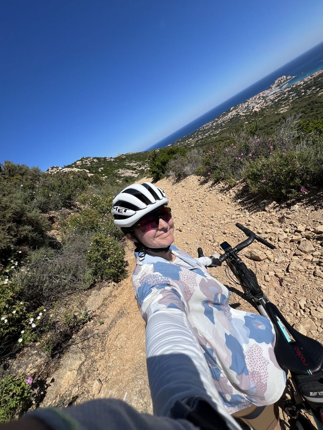
Hi! I’m Morgan, and I am fairly new to the gravel world. I come from a (semi) long-history of road biking: 10 years, which when considering I’m 28, is a good chunk of my life. Like most folks, I was quickly intrigued by the gravel medium, the off-road possibilities, the chance to pedal on dirt roads far away from aggravated or distracted drivers. I recently spent a week on the French island of Corsica with my van, my road bike, and the newest addition: my super sexy Flaanimal Ti. This bike will soon become my swiss-army-bike: a bike that can excel on any terrain, whether the distance be a short 50k road race or a multi-day bikepacking event in the Alps. But for now, it’s my adventure gravel bike, and boy was I ready to have some of those in a place I’ve never been. Below, I share with you two of my more memorable adventures from my time riding on the island.
Memorable Adventure 1: No GPS? No Problem
On May 4th, I boarded a ferry to take me to Ajaccio, a southern city on the French island of Corsica, itself about 6 hours from the mainland, floating in the Mediterranean sea. As I waited to drive my car onto the vessel, I was fervently searching ‘gravel corse trace’ (the French equivalent for gravel route Corsica) trying to find routes that looked interesting. (What, you’re telling me that you have all of your routes planned before arriving at your destination? Chapeau, if you do. Me? I will plan out every detail of my trip, except for bike routes. That is an activity for the night before or even morning of, and will be dependent on weather and how I feel. There is a certain luxury having a home-base-on-wheels affords when vacationing with bikes.) Most routes I came across were, unfortunately, either point-to-point (which is not ideal when you have a van as your home base) or included 80%+ of road, which did not scream ‘super cool gravel adventure’ to me. Shrugging my shoulders, I ended up downloading some mountain bike routes that were more or less in the area I’d be staying in, and called it a day. Surely I’d have more time when I got to my campsite to search for routes closer to me.
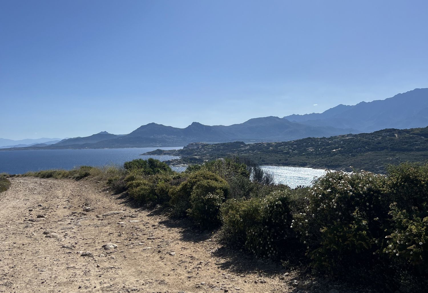
When I arrived at my campsite, however, I realized I had no service. I walked around for a bit, searching for the tiniest bar of 4G to at least open up Strava and screenshot the beginning of a route I wanted to try. After a few minutes, success! I got my one screenshot, and figured that I’d eventually get service while riding tomorrow to get the rest of the route up. The next morning, with only one last look at where I needed to turn, I started off on my route. One thing to note about Corsica: it’s an island, but it’s a mountainous island. The only sort of flat reprieve you may find is along the coast, and even then, if you’re cycling on the western half of the island like me, you may never find a stretch of flat road. You’re either climbing, or you’re descending. Naturally, my first turn after 200m of pedaling led me climbing up, up, and up, through a neighborhood of Mediterranean style houses embedded along the hillside. As I increased in elevation, so did the grandeur of the view: before me was the gulf of Ajaccio glimmering under the bright sun, the light blue water crashing onto sparkling white sand and a picturesque view of snow capped mountains in the far background. I was quite enamored as I tried to recall a place in this world to which I’ve been that had a similar landscape. I was unable to do so. Corsica was its own breathtaking slice of paradise for sport enthusiasts and it became clear why the true Corsicans, the people who have lived on this island way before it became part of France, would want this island all to themselves.
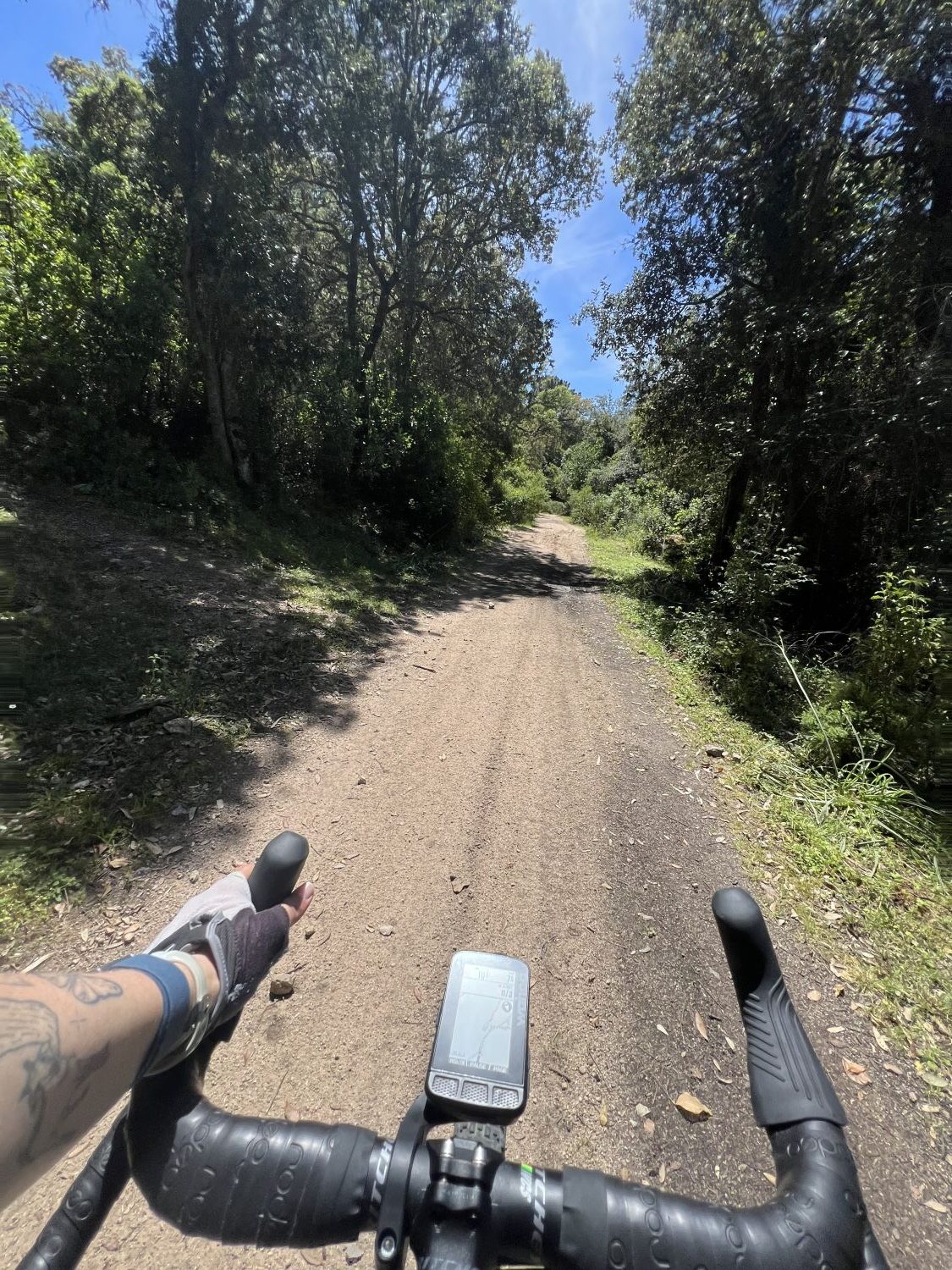
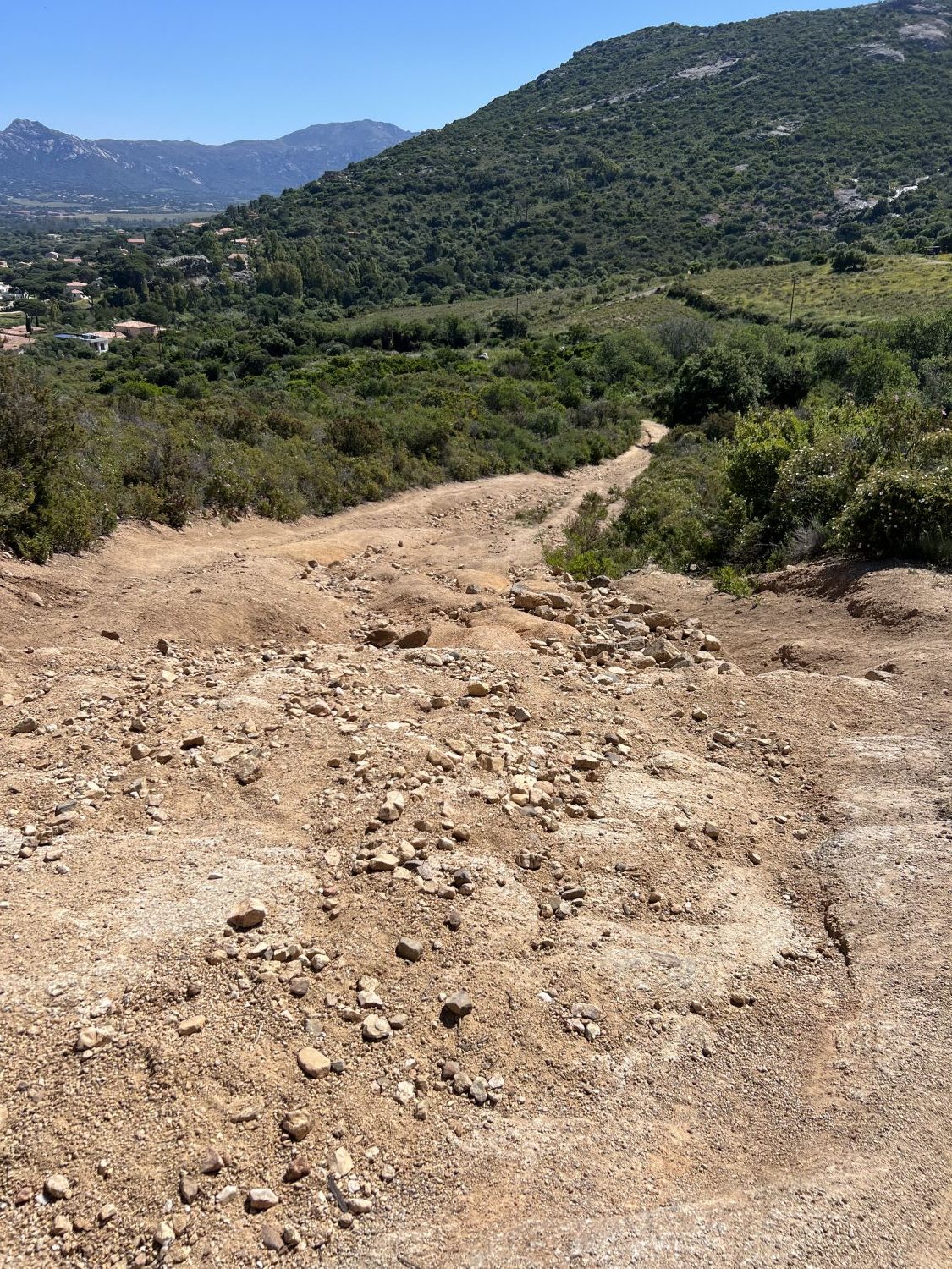
I finally arrived at the top of the neighborhood, where the asphalt stopped and the faint yellow, rocky soil began. A sign of a white circle, outlined in red means that no motorized vehicles are allowed on the road. This road, like many in the southern Mediterranean, are known (in french) as DFCI roads, or fire-protection roads. Since most of the southern part of the European continent is rather dry and hot, it is prone to wildfires. This network of dirt roads reach very remote places, often linked by water towers or observation stations and only accessible by authorized off-road vehicles. Fortunately for two-wheel enthusiasts like myself, these wide paths are accessible to cyclists, hikers, and even horseback riders. There is a bit of a gamble on these roads, however: you do not know the terrain beforehand, nor if it has been maintained recently. Depending on rainfall, you may find yourself with a very washed out road, or as I’ll find out in a few days (and you dear reader, if you keep reading) that some roads are not very gravel bike friendly at all.
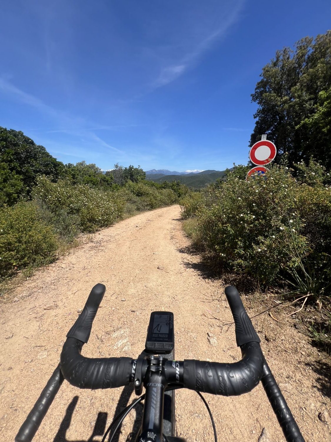
The path that I had chosen today should take me up one side of the Col de Gradella and spit me back out on a paved road, a few kilometers before the summit. Unfortunately for me, my route has not loaded onto my Wahoo, despite being on my Strava account, so I’m left to follow different dotted lines on the screen and zoom out from time to time and estimate if this is the correct path that I wanted to go on. Nothing like a bit of an adventure while riding by yourself for the first time in an unfamiliar place, right?
Fortunately for me, and what I will come to realize throughout the week, is that the gravel roads here are pretty freakin’ awesome. Sure, there are some rocky sections, but when climbing in mountainous terrain, this is to be expected. It’s how soil forms, when you think about it: millions of years of rock erosion. My dirt climb up the Col de Gradella had a mix of everything: super rocky sections that rattled my bones and challenged my inexperienced rider self as I fought to pedal over rocks and stay clipped in, dusty dirt paths in the sunshine that led to a snake sighting (and then for the rest of the week many false alarms that were only tree branches) and shaded forest paths, humid from the moisture locked in by the canopy of foliage overhead. I was not in search of a QOM on these paths; rather, I wanted to pedal as slowly as I could, savoring each second of forest bliss. The marrying of biking and off-road paths speaks directly to my soul: a few years back, I was an avid backpacker and hiker, living in my Honda Civic for an entire summer and spending my days hiking throughout Arizona and California. The solitude of nature is something I hadn’t been able to consistently find with road cycling. Here, in Corsica, on the bike, I felt the melding of my favorite hobby with the pleasure of moving on dirt paths, listening to the fauna and the hum of nature around me.
I eventually rejoined the road (aka, reprieve for this accustomed roadie!!) that led me up and over the col, and you guessed it, right back up another one. This time, though, I was looking over the gulf of Valinco, even farther south and closer to the Italian island, Sardinia. At one point I stopped on the side of the road to pause and just admire the view, even squinting my eyes to see if maybe I could make out Sardinia in the distance (I don’t think I did.) The 45mm tires aren’t super forgiving on asphalt, especially while climbing, but I loved the plushiness they added to the overall ride. I knew I would be on dirt again soon. The only cars that passed me on the road were oddly enough, Porsches, as I later discovered there was a Porsche car rally happening. Thankfully, despite the tiny roads, there were so few drivers that they gave me more space while passing than I think any car on the French mainland has.
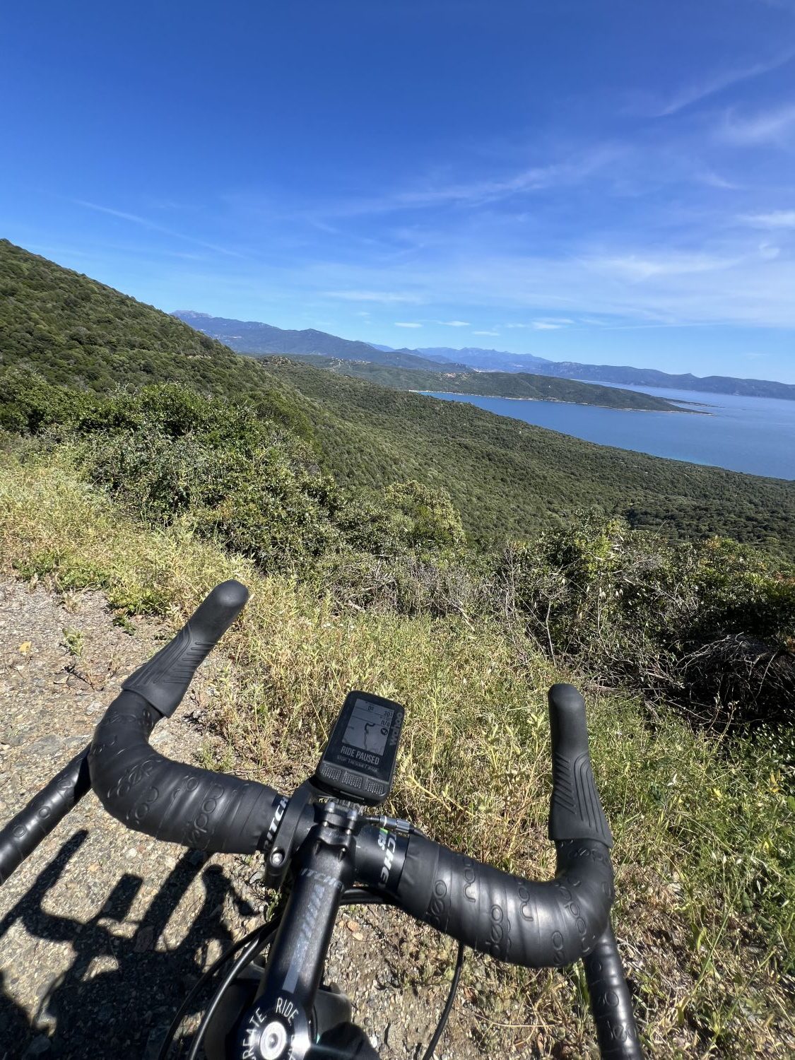
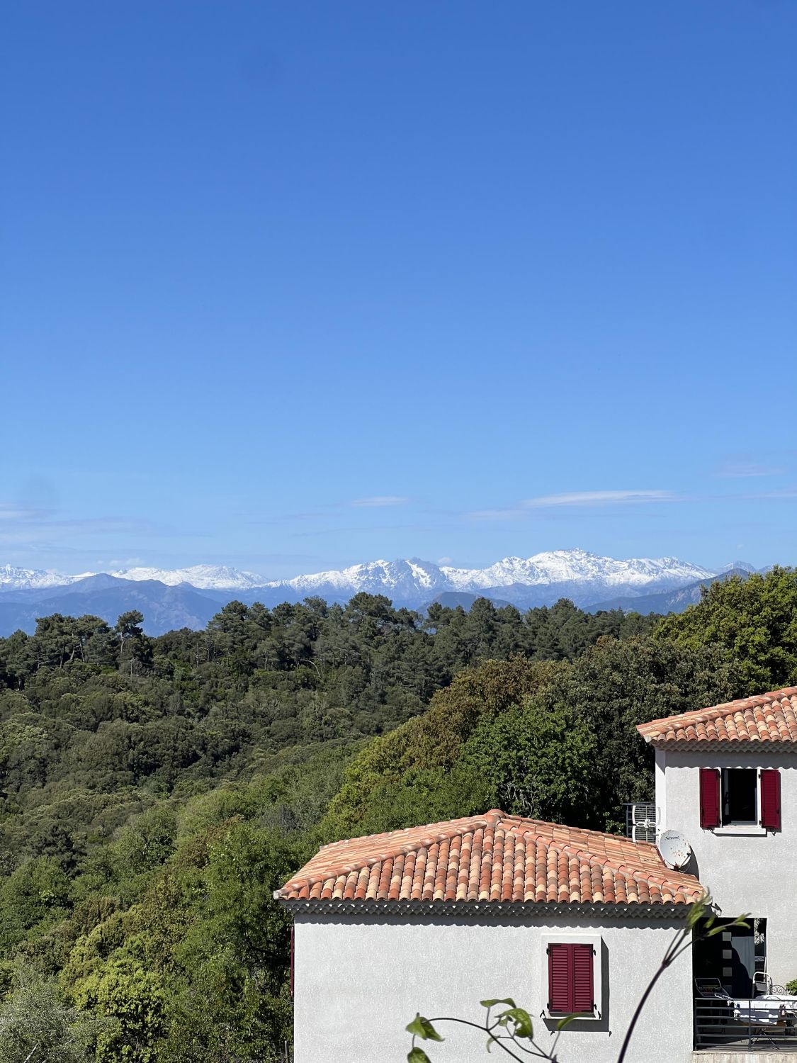
I followed this road around to a town called Coti Chiavari where many camper vans were stopped to admire another view of the snow capped mountains in the distance. I, of course, stopped to do the same. It’s not every year that the mountains retain their snow, or even receive snow, I later learned. After this passage, I was able to rejoin the dirt paths of the Chiavari forest and start my descent. My tires rolled over leaf detritus, branches, and larger roots as I glided back down towards sea level under the canopy of trees. This cover didn’t last very long; soon the sky opened up and I was once again met with rocks and light colored dirt. I swear I am slower on the descents than when I climb: my mind works in overdrive to analyze the terrain in front of me and make a million micro-decisions a minute to select the path of least resistance to roll over. This requires way more concentration than even the most technical road descent. I squeeze my brake levers at varying intensities, perhaps the front one too much and it begins to overheat and squeal at the lightest feathering. With each meter I cover, I gain a bit more confidence. I look for the tire tracks, signs of previous choices that I assume, ended alright. I brace my legs and lift my butt out of the saddle to roll over rocks and finally, breathe a sigh of relief when I see hard packed dirt again and a less serious incline. When I reach the road again, a wave of endorphins rush over me and for as much as that was scary at times, I want to ride my bike up the hill and do it again.
————————–
Memorable adventure 2: Satellite imagery deception
For my last gravel ride in Corsica, I wanted to create my own route. (Okay, maybe the desire to create my own route wasn’t that strong, it was more that I couldn’t find any routes so I was a bit forced to do so. But hey, why not be that pioneer who finds routes that work to share them with others?)
For this, I used satellite imagery on Google maps and found dirt roads that looked rideable. Of course, it is hard to really deem a road ‘rideable’ from a grainy photo, but the road looked like it was dirt, and it looked wide enough to not be a single track, so I was hopeful. One day, I will go back and ride ALL the DFCI roads so that I can make a map of the ones that are suitable for gravel…but that’s for another adventure.
When I transferred these roads onto Strava, I was a tiny bit hopeful that I was doing something right, because there were darker blue lines on some roads which indicated that others in the Strava community had logged a biking activity on these roads. My plan was to do two giant loops: one around the Revetella Peninsula, and another around a nature reserve along the beach in Lumio, linked by a gravel road up and over a mountain with a view of Calvi. Oh, and I had firm lunch plans at one o’clock. Sometimes my head has a hard time gauging how long gravel rides will take me, as it is so used to road times and pacing. When I designed the route and saw 45km, I thought I could easily attack the distance in around 3 hours and have enough time to head back to my van, change, pack away the bike, and arrive on time for lunch. However, I also knew that I could do the first loop and then head back to the van if need be and forgo the second loop.
I was able to secure a parking spot just off the road where the Revetella Peninsula begins. If you continue on this main road (D81B), it will actually connect you to other coastal towns all along the western side of the island. It’s a stunning road, full of hairpin turns and constant climbing or descending, whether you are on the road with two wheels or four, but MAN is it pretty.
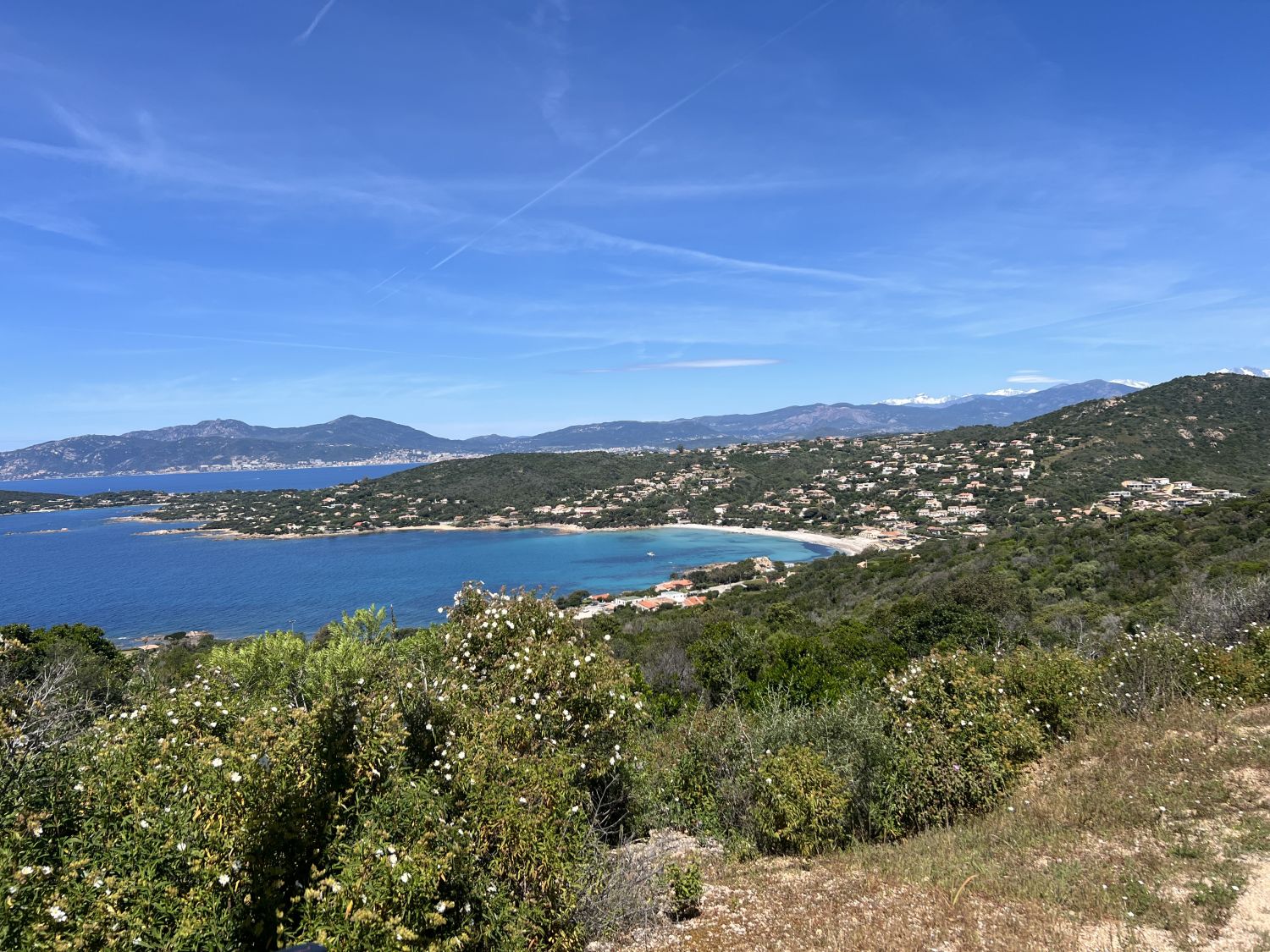
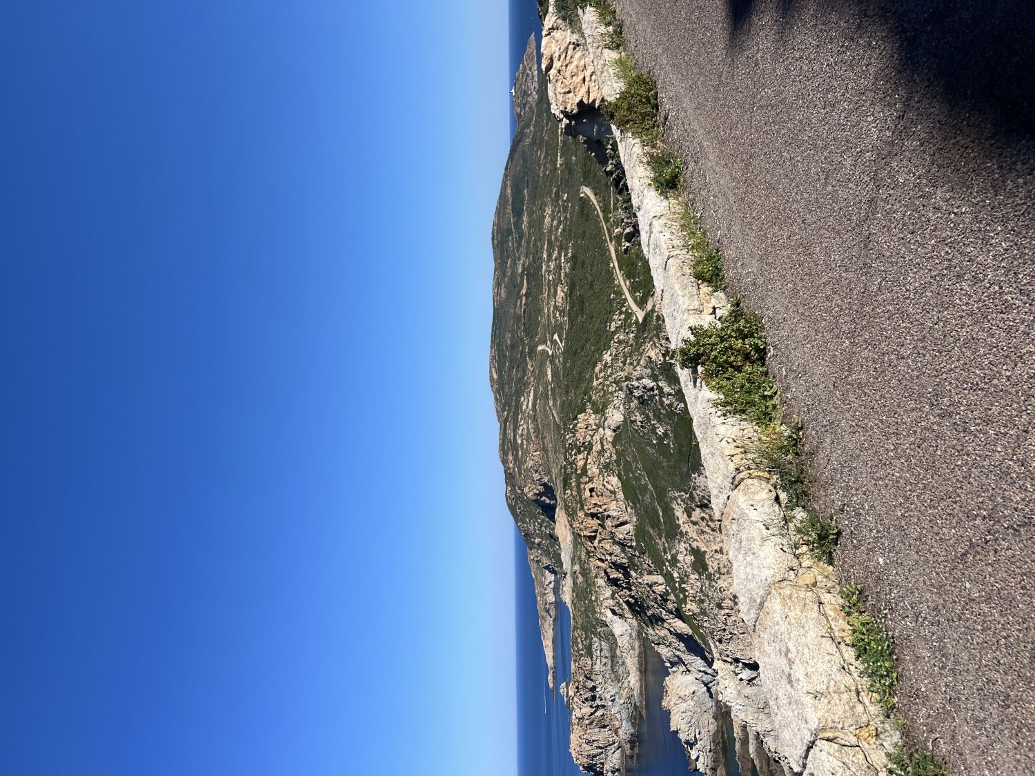
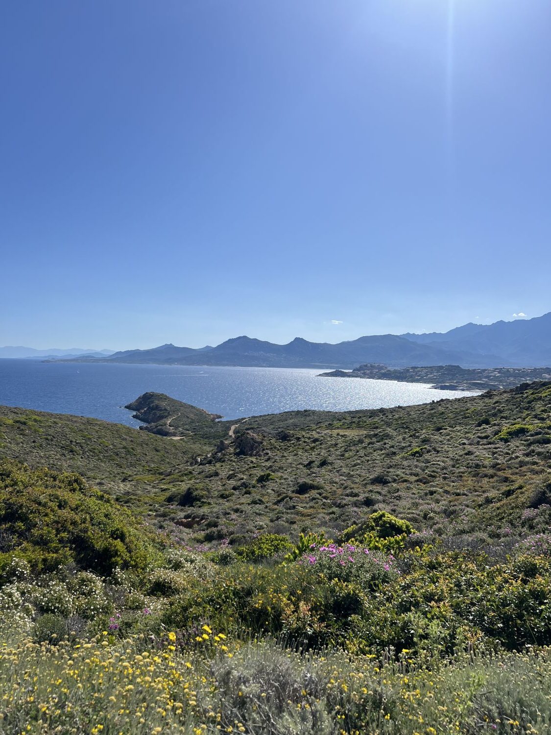
As I was pulling my bike out of the back of the van, I saw a tour group of electrified scooters come up the path I was supposed to head down. This reassured me, as I imagined that the road wouldn’t be too treacherous for my no-suspension gravel grinder. I rode up to the road and peered down to see a couple of hairpins and rocky roads with random patches of asphalt that clearly hadn’t been taken care of in quite some time. In the spirit of adventure, I clipped in and braced my body for the descent. Moving sometimes slower than a turtle (or so it felt) I braked generously and a couple of times, hopped off my bike to walk through patches of rocks I was unsure about. 700 meters later, I was rewarded with smooth dirt and sand to ride on, as well as incredible views of Calvi, the mountainous range in the distance, and the never-ending hues of greens, purples and yellows on the peninsula surrounding me. One could easily imagine carving out a couple more trails on the strait and calling it a gravel paradise. The path that I traced on Strava the night before as my return route ended up being a singletrack that looked pretty rocky, so I stuck to the wider 4×4 paths and retraced the way I came. I only once looked enviously at a mountain biker and their fork suspension. Maybe one day….
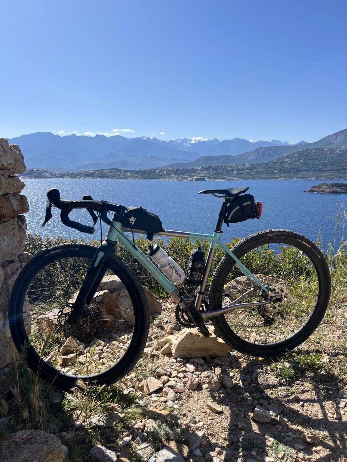
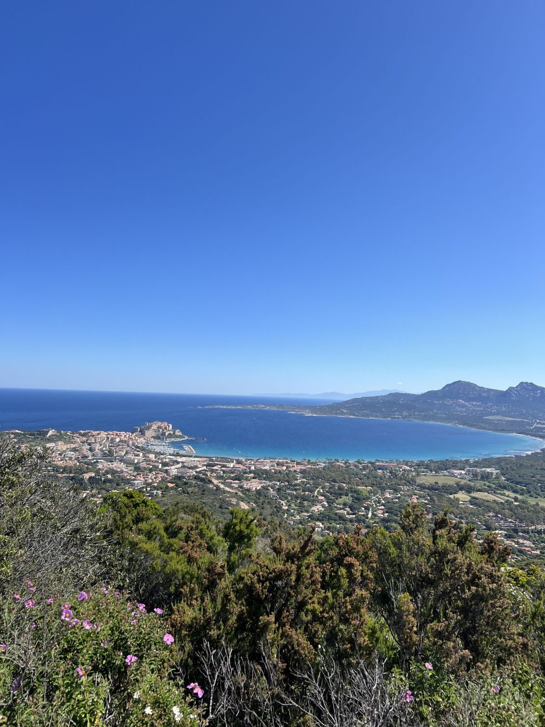
Once I arrived at the base of my 700m, rocky climb back to the parking lot, I shifted into the granny gear and started to pedal, finding it easier to go slower and anticipate the sections of the road that would be more forgiving on the gravel bike. As I rounded a corner, a family was coming down a hiking path and told me I was courageuse (brave) for biking up the hill. I just smiled, said merci, and pedaled along, thinking that it was more brave of me to bike down than up. My shaky legs arrived finally at the parking lot, but this was just the beginning. To get to my next gravel path, I’d have to climb up a very steep road that had sections of 16% and 20% grade. Panting like a dog but arriving at the top of Notre Dame de la Serra, I saw the dirt road I had chosen the night before and followed it. Certain sections were pure heaven, hard packed dirt with minimal rocks, and I rejoiced at the quality of this path. I thought once again to myself, ‘is this gravel paradise?’ I wanted the road to continue like this, and it did for a good while. I stopped multiple times to take photos of the almost 360-degree view.
Somewhere in the back of my mind, I knew this road was too good to be true. And maybe I should have turned around when I saw the path start to deteriorate. But I was determined to see my route through to the very end. I told myself “keep going! You’re getting your gravel legs.” I started on a descent that was pretty rocky, but nothing I hadn’t seen before. At first, I gently descended, following past mountain bike tires (or were they dirt bikes?) and stopping to walk my bike when it became too steep. Not too far off in the distance, I heard the engines of ATVs and realized they were approaching. I moved to the side of the trail on a heavily sloped angle, cradling my bike between my hip and rockface and watched while a group of tourists on ATVs followed a guide up the path I came down on. As I looked in the direction from which they came, I once again set off with determination. However, the realization quickly sets in that my once joyous gravel path has now become a steep ravine.
I am able to hop on my bike and pedal for 100m at a time, then I am forced to unclip and walk my bike because the terrain is clearly expert level to navigate and I feel hopelessly like a novice. Is this gravel? I can only laugh as I steer and push my bike down rocky trails with ruts big enough for my leg to slide into, silently telling myself I’m grateful to have gravel shoes on so I am somewhat able to walk, but also making the comment that I need proper hiking shoes if these are the adventures I will be taking myself on. If only Google Maps was able to tell you about the elevation while looking at satellite imagery!
The ravine rejoins the road and my whole body rejoices. I squeal like a piglet and plop back on the saddle, happy to be pedaling instead of walking. Glancing at the clock, I realize that I am way behind schedule and that my second loop will not be able to be completed as planned. After briefly getting lost in a neighborhood, I take one last glorious dirt path that leaves me with a good taste of gravel before my last few kilometers on tarmac back up to my van.
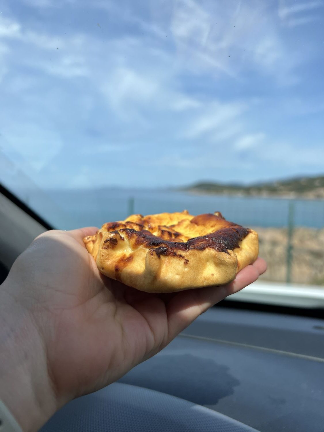
As with most vacations, they are never long enough and we wish that they could extend for much longer. This was true during my week in Corsica. However, I know that this is just the beginning of my tales from the island. I want to go back and ride the whole GT20, an approved road tour that explores the island by bike. There are also longer point-to-point gravel rides I would love to try and report back on. Even if I couldn’t bring a bike with me, I’d go back just to eat all of the varieties of the Corsican pastry Ambrucciata: on a buttery, fluffy French pastry crust sits a deletable Corsican goat cheese, folded together with local citrus zests (lemon, orange, or even both!) and baked in an oven. The result? A tangy, savory pastry that I ate almost. every. day.
Are you thinking of heading to Corsica for a bike vacation? Feel free to reach out to me on IG and I’d be happy to share what I learned from my time on the island. Who knows, maybe we’ll see each other out on the gravel trails!
No comment yet, add your voice below!